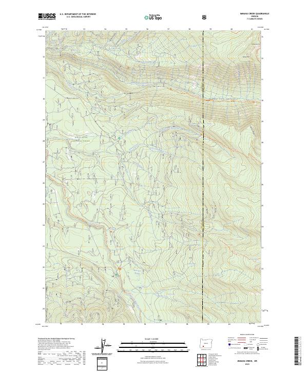
2023 Map of Imnaha Creek
USGS Topo · Published 2023About this map
Rogue River National Forest and the Sky Lakes Wilderness dominate this high-elevation landscape along the boundary of Jackson and Klamath counties. The terrain is defined by the headwaters of several major drainages, most notably the Middle Fork Rogue River and the South Fork Rogue River. These waterways are fed by numerous small tributaries including Imnaha Creek, Wallowa Creek, and Bessie Creek, illustrating a complex hydrological network carved into the volcanic Cascades.
Find a feature on this map
47 named features on this map. Tap any name to fly to it.
Don’t see what you’re looking for? This feature index may not catch every label — zoom into the map to look around manually.
Map Details
Editions of this 2023 Imnaha Creek Map
This is the sole edition of this map. No revisions or reprints were ever made.
Other maps of this area

1891 · Ashland
USGS Topo · 1:250,000

1893 · Ashland
USGS Topo · 1:250,000

1897 · Ashland
USGS Topo · 1:250,000

1955 · Rustler Peak
USGS Topo · 1:62,500

1955 · Pelican Butte
USGS Topo · 1:62,500

1955 · Medford
USGS Topo · 1:250,000

1956 · Prospect
USGS Topo · 1:62,500

1957 · Medford
USGS Topo · 1:250,000

1958 · Medford
USGS Topo · 1:250,000
1985 · Rustler Peak
USGS Topo · 1:24,000