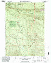
1997 Map of Imnaha Creek
USGS Topo · Published 2000About this map
Rogue River National Forest defines the character of this high-elevation landscape, where numerous tributaries feed the Middle Fork Rogue River. The 1997 revision highlights a topography dominated by steep drainages like Canyon Fork Rogue River and Lookout Gulch, revealing a wilderness area managed for both its natural resources and conservation. Evidence of the region's operational history is found in the scattered Gravel Pits and a Quarry, while specialized landmarks such as the King Spruce (Site) and Mountain Beaver Meadow suggest specific ecological or historical points of interest within the forest. To the east, the Sky Lakes Wilderness boundary begins its ascent toward Mudjekeewis Mtn, marking a transition into more protected, roadless terrain. Hydrological features are abundant, from the naming of Bikini Pond Spring and Geyser Spring to the flow of Imnaha Creek through the central portion of the sheet.
Find a feature on this map
38 named features on this map. Tap any name to fly to it.
Don’t see what you’re looking for? This feature index may not catch every label — zoom into the map to look around manually.
Map Details
Editions of this 1997 Imnaha Creek Map
This is the sole edition of this map. No revisions or reprints were ever made.
Other maps of this area

1891 · Ashland
USGS Topo · 1:250,000

1893 · Ashland
USGS Topo · 1:250,000

1897 · Ashland
USGS Topo · 1:250,000

1955 · Rustler Peak
USGS Topo · 1:62,500

1955 · Pelican Butte
USGS Topo · 1:62,500

1955 · Medford
USGS Topo · 1:250,000

1956 · Prospect
USGS Topo · 1:62,500

1957 · Medford
USGS Topo · 1:250,000

1958 · Medford
USGS Topo · 1:250,000
1985 · Rustler Peak
USGS Topo · 1:24,000