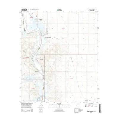
2014 Map of Imperial Reservoir
USGS Topo · Published 2014About this map
The Colorado River defines the border between Arizona and California in this arid river valley landscape. Centered on the Imperial Reservoir and the recreation-focused settlement of Martinez Lake, the area showcases a complex network of wetlands and backwaters preserved within the Imperial National Wildlife Refuge. The irrigation infrastructure critical to the region's agriculture is prominently marked, including the Gila Main Canal and Senator Wash Reservoir. Historic river access points like Fishers Landing and Castle Dome Landing indicate the long-standing importance of this waterway for navigation and local transport. To the east, the map detail extends to the Laguna Army Airfield (Yuma Proving Ground), while the western horizon is dominated by the jagged peaks of the Chocolate Mountains, accessible through Explorers Pass.
Find a feature on this map
36 named features on this map. Tap any name to fly to it.
Don’t see what you’re looking for? This feature index may not catch every label — zoom into the map to look around manually.
Map Details
Editions of this 2014 Imperial Reservoir Map
This is the sole edition of this map. No revisions or reprints were ever made.
Other maps of this area

1903 · Yuma
USGS Topo · 1:125,000

1905 · Yuma
USGS Topo · 1:125,000

1929 · Laguna
USGS Topo · 1:62,500

1939 · Red Hill
USGS Topo · 1:62,500

1942 · Yuma
USGS Topo · 1:250,000

1942 · Blythe
USGS Topo · 1:250,000

1943 · Laguna
USGS Topo · 1:62,500

1945 · Picacho Peak
USGS Topo · 1:62,500

1945 · Picacho
USGS Topo · 1:62,500

1951 · Picacho
USGS Topo · 1:62,500