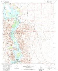
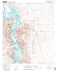
1955 Map of Imperial Reservoir
USGS Topo · Published 1983About this map
The Colorado River defines this landscape along the border of Arizona and California, where mid-century water management efforts are clearly visible. The massive Imperial Reservoir and Imperial Dam Spillway serve as the focal point for irrigation, feeding the Gila Main Canal and utilizing large Desilting Basins to manage the river's heavy sediment load. This survey captures the transition from pioneer-era river landings to modern military and conservation uses. For example, while the Castle Dome Landing (Site) is marked as a historic location, active development appears at Fishers Landing and the Yuma Test Station. Further inland, the Chocolate Mountains rise to the west, where the Old Senator Mine and Senator Wash indicate the area's prospecting history within the Imperial National Wildlife Refuge.
Find a feature on this map
28 named features on this map. Tap any name to fly to it.
Don’t see what you’re looking for? This feature index may not catch every label — zoom into the map to look around manually.
Map Details
Editions of this 1955 Imperial Reservoir Map
5 editions found
Other maps of this area

1903 · Yuma
USGS Topo · 1:125,000

1905 · Yuma
USGS Topo · 1:125,000

1929 · Laguna
USGS Topo · 1:62,500

1939 · Red Hill
USGS Topo · 1:62,500

1942 · Yuma
USGS Topo · 1:250,000

1942 · Blythe
USGS Topo · 1:250,000

1943 · Laguna
USGS Topo · 1:62,500

1945 · Picacho Peak
USGS Topo · 1:62,500

1945 · Picacho
USGS Topo · 1:62,500

1951 · Picacho
USGS Topo · 1:62,500