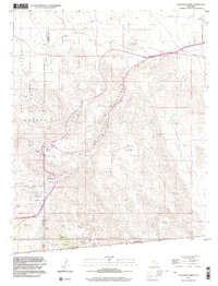
1997 Map of In-ko-pah Gorge
USGS Topo · Published 2003About this map
The Jacumba Mountains dominate this high-desert landscape along the United States-Mexico border, where the steep canyons and rocky terrain defined early travel routes through the region. A Stage Station Historical Marker near Mountain Spring serves as a reminder of the corridor's role as a vital passage for travelers and freight moving between the coast and the inland desert. The topography is deeply incised by Devils Canyon and the In-Ko-Pah Gorge, revealing the difficult geography that early road builders and miners had to navigate.
Find a feature on this map
25 named features on this map. Tap any name to fly to it.
Don’t see what you’re looking for? This feature index may not catch every label — zoom into the map to look around manually.
Map Details
Editions of this 1997 In-ko-pah Gorge Map
This is the sole edition of this map. No revisions or reprints were ever made.
Other maps of this area

1915 · El Centro
USGS Topo · 1:125,000

1931 · Carrizo
USGS Topo · 1:125,000

1939 · Jacumba
USGS Topo · 1:62,500

1940 · Plaster City
USGS Topo · 1:62,500

1940 · Coyote Wells
USGS Topo · 1:62,500

1942 · El Centro
USGS Topo · 1:250,000

1942 · Carrizo Mtn
USGS Topo · 1:62,500

1942 · Jacumba
USGS Topo · 1:62,500

1943 · Coyote Wells
USGS Topo · 1:62,500

1944 · Plaster City
USGS Topo · 1:62,500