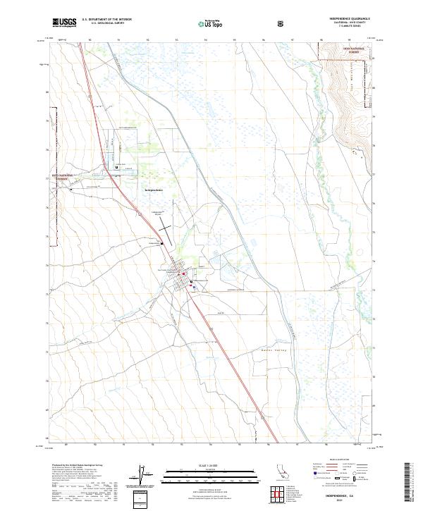
2021 Map of Independence
USGS Topo · Published 2021About this map
Independence serves as the focal point of this Eastern Sierra landscape, situated in the heart of the Owens Valley. The town is characterized by its civic significance, centered around the Inyo County Courthouse. The surrounding terrain transitions from the wetland environments of Tulare Swamp and Thibaut Ponds to the rising slopes of the Inyo Mountains and the Inyo National Forest. A major engineering presence is felt through the Los Angeles Aqueduct, which cuts through the valley floor alongside the natural course of the Owens River. Local history and genealogy are anchored by several burial sites, including the Old Independence Cem, the Independence Cem, and the Indian Cem. The map captures the meeting of high-desert infrastructure and early settlement patterns, connected by thoroughfares like Onion Valley Rd and Mazourka Canyon Rd.
Find a feature on this map
42 named features on this map. Tap any name to fly to it.
Don’t see what you’re looking for? This feature index may not catch every label — zoom into the map to look around manually.
Map Details
Editions of this 2021 Independence Map
This is the sole edition of this map. No revisions or reprints were ever made.
Other maps of this area

1907 · Mt. Whitney
USGS Topo · 1:125,000

1919 · Mt. Whitney
USGS Topo · 1:125,000

1937 · Mt. Whitney
USGS Topo · 1:125,000

1948 · Fresno
USGS Topo · 1:250,000

1951 · Independence
USGS Topo · 1:62,500

1953 · Mt. Pinchot
USGS Topo · 1:62,500

1955 · Fresno
USGS Topo · 1:250,000

1956 · Fresno
USGS Topo · 1:250,000

1956 · Mount Whitney
USGS Topo · 1:62,500

1958 · Fresno
USGS Topo · 1:250,000