
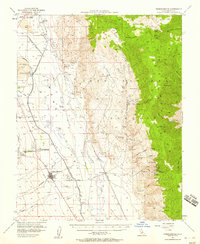
1951 Map of Independence
USGS Topo · Published 1953About this map
The Owens River and the massive Los Angeles Aqueduct define the industrial and agricultural character of this Owens Valley landscape during the early 1950s. While the valley floor is marked by the Southern Pacific rail line and local landmarks like the Mt Whitney Fish Hatchery and the Port Independence Indian Reservation, the eastern slopes of the Inyo Mountains reveal a rugged mining history. Numerous operations, including the Green Monster Mine, Blue Bell Mine, and the Alhambra Mine, are scattered across the high terrain, connected by precarious routes such as the Keyes Trail. This era also shows evidence of changing water management, with the Stevens Canal (Abandoned) and Eclipse Ditch (Aban'd) indicating the shifting irrigation and transport patterns that reshaped Inyo County.
Find a feature on this map
63 named features on this map. Tap any name to fly to it.
Don’t see what you’re looking for? This feature index may not catch every label — zoom into the map to look around manually.
Map Details
Editions of this 1951 Independence Map
4 editions found
Other maps of this area

1907 · Mt. Whitney
USGS Topo · 1:125,000

1908 · Lida
USGS Topo · 1:250,000

1908 · Ballarat
USGS Topo · 1:250,000

1913 · Bishop
USGS Topo · 1:125,000

1913 · Lida
USGS Topo · 1:250,000

1913 · Ballarat
USGS Topo · 1:250,000

1919 · Mt. Whitney
USGS Topo · 1:125,000

1937 · Mt. Whitney
USGS Topo · 1:125,000

1947 · Mariposa
USGS Topo · 1:250,000

1948 · Death Valley
USGS Topo · 1:250,000