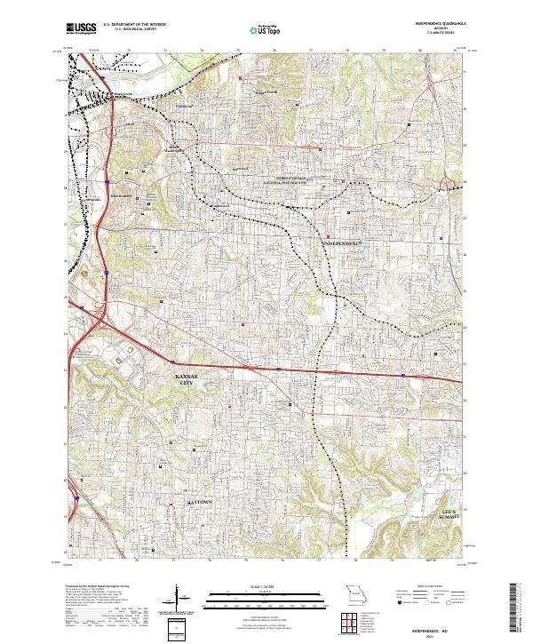
2021 Map of Independence
USGS Topo · Published 2021About this map
Independence and its immediate neighbors in Jackson County are charted here with modern precision, showcasing the dense residential and industrial grid that characterizes this part of the Kansas City metropolitan area. The prominent Harry S Truman National Historic Site sits at the heart of the city, surrounded by historic neighborhoods like Maywood, Englewood, and Fairmount. The terrain is marked by a high concentration of burial grounds, including the expansive Mount Washington Cem and Mound Grove Cem, which serve as vital landmarks for local historians and genealogists.
Find a feature on this map
235 named features on this map. Tap any name to fly to it.
Don’t see what you’re looking for? This feature index may not catch every label — zoom into the map to look around manually.
Map Details
Editions of this 2021 Independence Map
This is the sole edition of this map. No revisions or reprints were ever made.
Other maps of this area

1887 · Harrisonville
USGS Topo · 1:125,000

1887 · Olathe
USGS Topo · 1:125,000

1890 · Kansas City
USGS Topo · 1:125,000

1892 · Harrisonville
USGS Topo · 1:125,000

1893 · Olathe
USGS Topo · 1:125,000

1894 · Kansas City
USGS Topo · 1:125,000

1894 · Harrisonville
USGS Topo · 1:125,000

1894 · Independence
USGS Topo · 1:125,000

1933 · Blue Springs
USGS Topo · 1:24,000

1934 · Independence
USGS Topo · 1:24,000