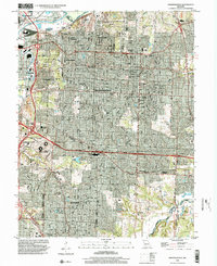
1996 Map of Independence
USGS Topo · Published 2002About this map
The Harry S Truman Sports Complex dominates the western portion of this 1990s landscape, illustrating the suburban evolution of the area between Kansas City and Independence. This era shows a dense network of residential neighborhoods and industrial zones, particularly around Leeds and Centropolis. The heavy rail influence of the Kansas City Southern and Missouri Pacific lines remains evident, supporting the region's long-standing role as a transportation hub.
Find a feature on this map
65 named features on this map. Tap any name to fly to it.
Don’t see what you’re looking for? This feature index may not catch every label — zoom into the map to look around manually.
Map Details
Editions of this 1996 Independence Map
This is the sole edition of this map. No revisions or reprints were ever made.
Other maps of this area

1887 · Harrisonville
USGS Topo · 1:125,000

1887 · Olathe
USGS Topo · 1:125,000

1890 · Kansas City
USGS Topo · 1:125,000

1892 · Harrisonville
USGS Topo · 1:125,000

1893 · Olathe
USGS Topo · 1:125,000

1894 · Kansas City
USGS Topo · 1:125,000

1894 · Harrisonville
USGS Topo · 1:125,000

1894 · Independence
USGS Topo · 1:125,000

1933 · Blue Springs
USGS Topo · 1:24,000

1934 · Independence
USGS Topo · 1:24,000