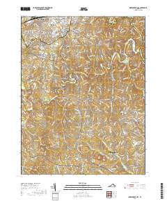
2019 Map of Independent Hill
USGS Topo · Published 2019About this map
The Occoquan River snakes through this portion of Prince William County, defining a landscape of residential expansion and preserved forest land. Near the center of the map, the Culpeper Basin and the dammed waters of Lake Jackson serve as geographic focal points, flanked by long-established communities such as Buckhall, Canova, and Brentsville. The southern reaches are dominated by the northern boundaries of MCB Quantico and the Prince William Forest Park, where the headwaters of Quantico Cr and its south fork originate.
Find a feature on this map
45 named features on this map. Tap any name to fly to it.
Don’t see what you’re looking for? This feature index may not catch every label — zoom into the map to look around manually.
Map Details
Editions of this 2019 Independent Hill Map
This is the sole edition of this map. No revisions or reprints were ever made.
Other maps of this area

1890 · Mt. Vernon
USGS Topo · 1:125,000

1891 · Mt. Vernon
USGS Topo · 1:125,000

1894 · Warrenton
USGS Topo · 1:125,000

1894 · Mt. Vernon
USGS Topo · 1:125,000

1897 · Mt. Vernon
USGS Topo · 1:125,000

1915 · Fairfax
USGS Topo · 1:62,500

1927 · Quantico
USGS Topo · 1:62,500

1933 · Middleburg
USGS Topo · 1:62,500

1940 · Quantico
USGS Topo · 1:62,500

1943 · Quantico
USGS Topo · 1:62,500