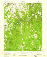
1956 Map of Independent Hill
USGS Topo · Published 1959About this map
Lake Jackson and the winding course of Occoquan Creek dominate this mid-century survey of the Prince William County landscape. To the north, the growing hub of Manassas is clearly defined, featuring the Old Dominion Speedway, the County Fairgrounds, and educational institutions like Osbourn High Sch. The map records a transition from the structured street grids of the northern settlements to the rural, forested stretches of the Prince William Forest Park and the northern edge of Quantico Marine Base.
Find a feature on this map
41 named features on this map. Tap any name to fly to it.
Don’t see what you’re looking for? This feature index may not catch every label — zoom into the map to look around manually.
Map Details
Editions of this 1956 Independent Hill Map
This is the sole edition of this map. No revisions or reprints were ever made.
Other maps of this area

1890 · Mt. Vernon
USGS Topo · 1:125,000

1891 · Mt. Vernon
USGS Topo · 1:125,000

1894 · Warrenton
USGS Topo · 1:125,000

1894 · Mt. Vernon
USGS Topo · 1:125,000

1897 · Mt. Vernon
USGS Topo · 1:125,000

1915 · Fairfax
USGS Topo · 1:62,500

1927 · Quantico
USGS Topo · 1:62,500

1933 · Middleburg
USGS Topo · 1:62,500

1940 · Quantico
USGS Topo · 1:62,500

1943 · Quantico
USGS Topo · 1:62,500