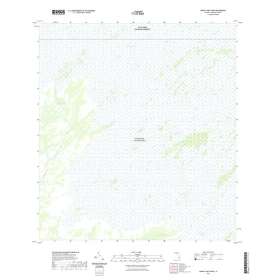
2021 Map of Indian Camp Creek
USGS Topo · Published 2021About this map
Everglades National Park and Big Cypress National Preserve meet in this 2021 survey, documenting the intricate hydrology of Monroe County’s southern wilderness. The landscape is defined by the slow movement of water through The Everglades, where distinct drainage systems like Indian Camp Creek and Rodgers Creek weave toward the coast. The presence of Shark River Slough in the southeast corner indicates the map's position within a vital freshwater flow-way. Unlike more developed regions, the absence of roads and human structures highlights a region managed for preservation. Natural features such as East Slough and the Broad River demonstrate the complex network of tidal creeks and sloughs that dictate the character of this subtropical environment.
Find a feature on this map
11 named features on this map. Tap any name to fly to it.
Don’t see what you’re looking for? This feature index may not catch every label — zoom into the map to look around manually.
Map Details
Editions of this 2021 Indian Camp Creek Map
This is the sole edition of this map. No revisions or reprints were ever made.
Other maps of this area

1956 · Miami
USGS Topo · 1:250,000

1958 · Miami
USGS Topo · 1:250,000

1972 · Shark Valley Lookout Tower
USGS Topo · 1:24,000

1972 · Harney River
USGS Topo · 1:24,000

1972 · Lostmans Trail
USGS Topo · 1:24,000

1972 · Big Boy Lake
USGS Topo · 1:24,000

1972 · Panther Mound
USGS Topo · 1:24,000

1972 · Tarpon Bay
USGS Topo · 1:24,000

1972 · Indian Camp Creek
USGS Topo · 1:24,000

1972 · Pa Hay Okee Lookout Tower
USGS Topo · 1:24,000