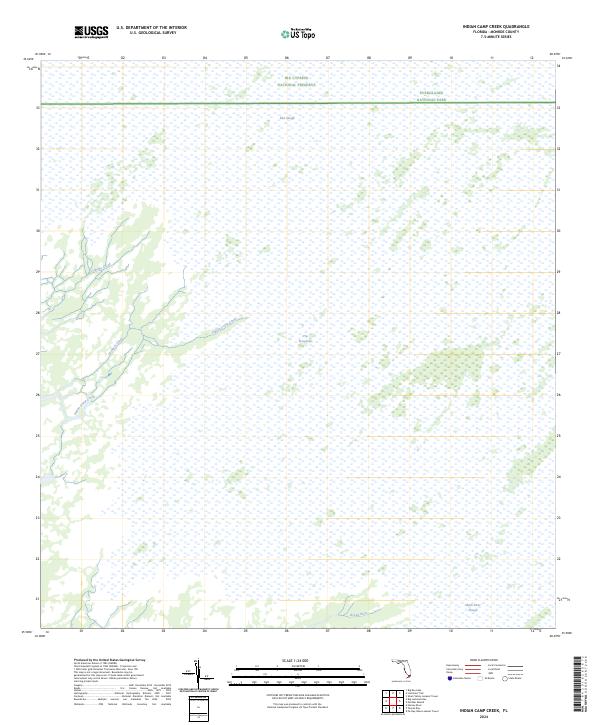
2024 Map of Indian Camp Creek
USGS Topo · Published 2024About this map
Marjory Stoneman Douglas Wilderness dominates this 2024 survey of the Florida interior, where the boundaries of Everglades National Park and the Big Cypress National Preserve meet. The landscape is characterized by a complex network of freshwater sloughs and tidal creeks that define the western edge of The Everglades. Notable watercourses include Indian Camp Creek, Lostmans Creek, and Rodgers Creek, which wind through the wetlands toward the Gulf coast. In the northern section, East Slough provides a key drainage feature, while the southern portion is marked by the Broad River and the significant Shark River Slough. This map illustrates the protected environmental continuity between these massive federal preserves, showcasing a region defined entirely by its hydrography and wilderness status rather than human settlement or infrastructure.
Find a feature on this map
12 named features on this map. Tap any name to fly to it.
Don’t see what you’re looking for? This feature index may not catch every label — zoom into the map to look around manually.
Map Details
Editions of this 2024 Indian Camp Creek Map
This is the sole edition of this map. No revisions or reprints were ever made.
Other maps of this area

1956 · Miami
USGS Topo · 1:250,000

1958 · Miami
USGS Topo · 1:250,000

1972 · Shark Valley Lookout Tower
USGS Topo · 1:24,000

1972 · Harney River
USGS Topo · 1:24,000

1972 · Lostmans Trail
USGS Topo · 1:24,000

1972 · Big Boy Lake
USGS Topo · 1:24,000

1972 · Panther Mound
USGS Topo · 1:24,000

1972 · Tarpon Bay
USGS Topo · 1:24,000

1972 · Indian Camp Creek
USGS Topo · 1:24,000

1972 · Pa Hay Okee Lookout Tower
USGS Topo · 1:24,000