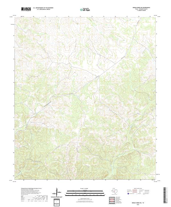
2022 Map of Indian Creek NE
USGS Topo · Published 2022About this map
Possum Spring and the drainage of Possum Cr anchor the southwestern portion of this Edwards County landscape, where the topography is defined by intricate draws and winding seasonal creek beds. The drainage network includes the notable Little Hackberry Draw and Indian Cr, illustrating the complex watershed patterns typical of this part of the Texas Hill Country. The transportation network is dominated by Ranch Rd 674, which cuts a long diagonal path across the limestone-etched terrain, connecting with remote local routes such as Hog Heaven Rd and Deer Cabins Rd. A specific residential or development project identified as Indian Creek Phase I appears in the southwest, signaling modern land use transitions in a region traditionally dominated by large ranching tracts.
Find a feature on this map
12 named features on this map. Tap any name to fly to it.
Don’t see what you’re looking for? This feature index may not catch every label — zoom into the map to look around manually.
Map Details
Editions of this 2022 Indian Creek NE Map
This is the sole edition of this map. No revisions or reprints were ever made.
Other maps of this area

1893 · Rock Springs
USGS Topo · 1:125,000

1893 · Nueces
USGS Topo · 1:125,000

1896 · Nueces
USGS Topo · 1:125,000

1944 · Indian Creek
USGS Topo · 1:62,500

1947 · Hackberry
USGS Topo · 1:62,500

1954 · Sonora
USGS Topo · 1:250,000

1958 · Sonora
USGS Topo · 1:250,000

1958 · Del Rio
USGS Topo · 1:250,000

1964 · Del Rio
USGS Topo · 1:250,000
1971 · Ray Lake SE
USGS Topo · 1:24,000