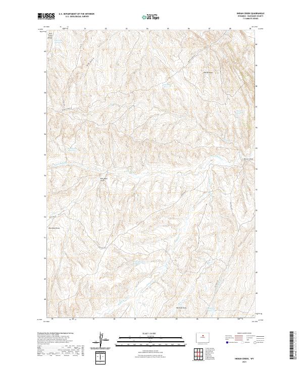
2021 Map of Indian Creek
USGS Topo · Published 2021About this map
Little Cedar Ridge dominates the northern reaches of this landscape, a terrain defined by deep-cut draws and a sophisticated network of small reservoirs supporting ranching and land management in Washakie County. The map documents a complex system of seasonal water management, featuring named sites like Homestead Reservoir, Best Place Reservoir, and Big Trails Reservoir. These features, along with the meandering courses of Buffalo Cr and its northern fork, illustrate the vital role of water capture in this arid environment. Transportation through the high country is facilitated by established routes such as Big Trails Rd and Buffalo Creek Rd, which navigate the various gulches and draws. The presence of Mud Gulch, Horton Draw, and Werland Draw highlights the erosion-carved character of the region, providing specific landmarks for researchers studying local geography and land use patterns.
Find a feature on this map
26 named features on this map. Tap any name to fly to it.
Don’t see what you’re looking for? This feature index may not catch every label — zoom into the map to look around manually.
Map Details
Editions of this 2021 Indian Creek Map
This is the sole edition of this map. No revisions or reprints were ever made.
Other maps of this area

1955 · Arminto
USGS Topo · 1:250,000

1958 · Arminto
USGS Topo · 1:250,000

1962 · Arminto
USGS Topo · 1:250,000

1966 · Big Trails
USGS Topo · 1:24,000

1966 · Big Trails NE
USGS Topo · 1:24,000

1966 · Deadline Draw
USGS Topo · 1:24,000

1966 · Indian Creek
USGS Topo · 1:24,000

1966 · Sand Point
USGS Topo · 1:24,000
1966 · Joe Emge Creek
USGS Topo · 1:24,000
1966 · Castle Gardens
USGS Topo · 1:24,000