
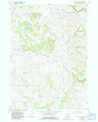
1966 Map of Big Trails NE
USGS Topo · Published 1970About this map
Canyon Creek Ranch and Taylor Bros Ranch anchor this mid-1960s landscape of high-country drainage systems in Washakie County. The map reveals an area defined by its hydrology and livestock operations, where Alkali Creek and Otter Creek carve through the terrain alongside distinctive features like Woods Gulch and Cooks Canyon. Infrastructure is centered around ranching and limited recreation, evidenced by the Girl Scout National Center Road (Boundary) and a remote Landing Strip near the W Diamond Ranch. A small Cem (cemetery) and water sources like Coyote Spring and a marked Well indicate the sparse but vital human footprint required to sustain life in this arid region of the Bighorn Basin watershed.
Find a feature on this map
22 named features on this map. Tap any name to fly to it.
Don’t see what you’re looking for? This feature index may not catch every label — zoom into the map to look around manually.
Map Details
Editions of this 1966 Big Trails NE Map
2 editions found
Other maps of this area

1899 · Cloud peak
USGS Topo · 1:125,000

1901 · Cloud Peak
USGS Topo · 1:125,000

1955 · Sheridan
USGS Topo · 1:250,000

1955 · Arminto
USGS Topo · 1:250,000

1958 · Sheridan
USGS Topo · 1:250,000

1958 · Arminto
USGS Topo · 1:250,000

1962 · Sheridan
USGS Topo · 1:250,000

1962 · Arminto
USGS Topo · 1:250,000

1966 · Monument Hill
USGS Topo · 1:24,000

1966 · Big Trails
USGS Topo · 1:24,000