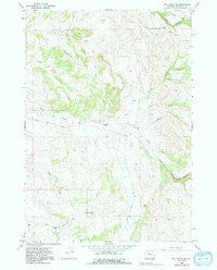
1966 Map of Big Trails NE
USGS Topo · Published 1991About this map
Washakie County ranchlands define this 1966 topographic survey, showing a landscape shaped by remote operations and essential water sources. The map records the Canyon Creek Ranch in the north and the Taylor Bros Ranch near the center, alongside several family-named water features such as Taylor Spring and Coyote Spring. This era in Wyoming's history saw the continued importance of high-country grazing, supported by a network of unimproved tracks like Mazet Road and the Spring Creek Road. A notable cultural landmark appears in the northeast: the Rome Girl Scout National Center Road, indicating the presence of regional youth organizations. For researchers of western land use, the inclusion of a Landing Strip near W Diamond Ranch illustrates the transition toward aerial support for managing expansive sheep and cattle operations in the mid-20th century.
Find a feature on this map
24 named features on this map. Tap any name to fly to it.
Don’t see what you’re looking for? This feature index may not catch every label — zoom into the map to look around manually.
Map Details
Editions of this 1966 Big Trails NE Map
2 editions found

Other maps of this area

1899 · Cloud peak
USGS Topo · 1:125,000

1901 · Cloud Peak
USGS Topo · 1:125,000

1955 · Sheridan
USGS Topo · 1:250,000

1955 · Arminto
USGS Topo · 1:250,000

1958 · Sheridan
USGS Topo · 1:250,000

1958 · Arminto
USGS Topo · 1:250,000

1962 · Sheridan
USGS Topo · 1:250,000

1962 · Arminto
USGS Topo · 1:250,000

1966 · Monument Hill
USGS Topo · 1:24,000

1966 · Big Trails
USGS Topo · 1:24,000