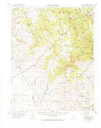
1962 Map of Indian Gulch
USGS Topo · Published 1964About this map
Hornitos and the surrounding foothill country of the Guadalupe Mountains reveal a landscape defined by 19th-century resource extraction and early ranching. This mid-century survey illustrates a dense network of gold-era mining claims, including the Ruth Pierce Mine, Pocahontas Mine, and Great Northern Mine. Settlement patterns are anchored by small communities like Catheys Valley and established family holdings such as Cunningham Ranch and Chase Ranch.
Find a feature on this map
106 named features on this map. Tap any name to fly to it.
Don’t see what you’re looking for? This feature index may not catch every label — zoom into the map to look around manually.
Map Details
Editions of this 1962 Indian Gulch Map
This is the sole edition of this map. No revisions or reprints were ever made.
Other maps of this area

1893 · Sonora
USGS Topo · 1:125,000

1896 · Sonora
USGS Topo · 1:125,000

1897 · Sonora
USGS Topo · 1:125,000

1897 · Yosemite
USGS Topo · 1:125,000

1898 · Sonora
USGS Topo · 1:125,000

1900 · Yosemite
USGS Topo · 1:125,000

1903 · Yosemite
USGS Topo · 1:125,000

1909 · Yosemite
USGS Topo · 1:125,000

1912 · Mariposa
USGS Topo · 1:125,000

1915 · Owens Creek
USGS Topo · 1:31,680