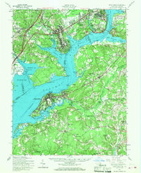
1956 Map of Indian Head
USGS Topo · Published 1968About this map
The Indian Head Powder Factory and Fort Belvoir Military Reservation anchor this mid-century landscape where the Potomac River divides Virginia and Maryland. This survey reveals a region defined by federal installations and deep colonial roots, stretching from the District of Columbia Department of Corrections at Lorton down to the historic Maryland port of Port Tobacco. The industrial presence is marked by the U S Government Railroad and tactical sidings like Rasmussen Siding, while older spiritual and estate landmarks such as Mt Carmel Monastery, Haber de Venture, and Pohick Ch persist amid the post-war growth of Potomac Heights and Woodbridge. Transportation patterns are captured in the transition from traditional water crossings at Marshall Hall to the emerging infrastructure of the Maryland Airport and the expansion of the Indian Head Highway.
Find a feature on this map
135 named features on this map. Tap any name to fly to it.
Don’t see what you’re looking for? This feature index may not catch every label — zoom into the map to look around manually.
Map Details
Editions of this 1956 Indian Head Map
2 editions found
Other maps of this area

1889 · Fredericksburg
USGS Topo · 1:125,000

1890 · Mt. Vernon
USGS Topo · 1:125,000

1891 · Mt. Vernon
USGS Topo · 1:125,000

1892 · Fredericksburg
USGS Topo · 1:125,000

1892 · Brandywine
USGS Topo · 1:62,500

1894 · Wicomico
USGS Topo · 1:62,500

1894 · Fredericksburg
USGS Topo · 1:125,000

1894 · Mt. Vernon
USGS Topo · 1:125,000

1895 · Wicomico
USGS Topo · 1:62,500

1895 · Brandywine
USGS Topo · 1:62,500