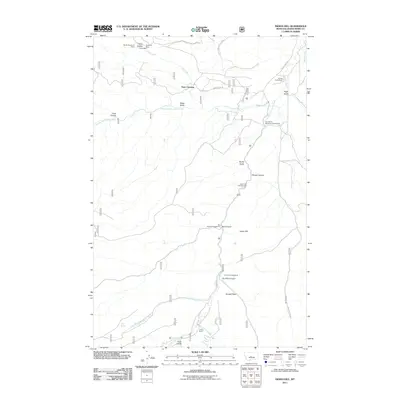
2011 Map of Indian Hill
USGS Topo · Published 2011About this map
Vortex Mine and the American Mine highlight the mineral history of this Judith Basin landscape, situated along the northern slopes near Yogo Creek. The terrain is defined by the convergence of the Middle Fork Judith River and the South Fork Judith River, which join to form the main Judith River in the northeast. This area serves as a focal point for backcountry access, marked by Yogo Crossing and a network of campsites including the Fred M Ellis Memorial Campground and Indian Hill Campground. The presence of the Korells Dude Ranch near Pagil Gulch suggests a transition from industrial mining roots toward recreation and ranching. Prominent local landmarks such as Russell Point and Indian Hill provide significant vertical relief above the deep-cut drainages of Bower Canyon and Hay Canyon.
Find a feature on this map
30 named features on this map. Tap any name to fly to it.
Don’t see what you’re looking for? This feature index may not catch every label — zoom into the map to look around manually.
Map Details
Editions of this 2011 Indian Hill Map
This is the sole edition of this map. No revisions or reprints were ever made.
Other maps of this area

1886 · Little Belt Mts.
USGS Topo · 1:250,000

1894 · Little Belt Mts.
USGS Topo · 1:250,000

1897 · Little Belt Mts.
USGS Topo · 1:250,000

1898 · Little Belt Mts.
USGS Topo · 1:250,000

1902 · Little Belt Mts.
USGS Topo · 1:250,000

1948 · White Sulphur Springs
USGS Topo · 1:250,000

1958 · White Sulphur Springs
USGS Topo · 1:250,000

1961 · White Sulphur Springs
USGS Topo · 1:250,000

1965 · White Sulphur Springs
USGS Topo · 1:250,000
1970 · Woodhurst Mountain
USGS Topo · 1:24,000