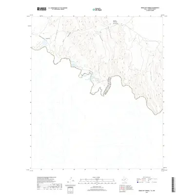
2019 Map of Indian Hot Springs
USGS Topo · Published 2019About this map
The Rio Grande snakes along the international border in this arid corner of West Texas, creating a sharp divide between the United States and Mexico. Tucked into the bends of the river, the unique mineral waters of Indian Hot Springs are joined by a cluster of named outflows including Beauty Spring, Soda Spring, and Dynamite Spring. This landscape is defined by its isolation and its hydrological features, with Indian Hot Spring Rd providing the primary access through the surrounding desert terrain. North of the river, the land rises into the high peaks of the Quitman Mountains and the dramatic relief of Red Bull Hill. Drainage patterns are marked by deep incisions such as Mayfield Canyon and Goat Canyon, which funnel toward the river. To the west, the Gibson Reservoir and Red Bull Spring indicate the critical importance of water management in this high-desert environment.
Find a feature on this map
21 named features on this map. Tap any name to fly to it.
Don’t see what you’re looking for? This feature index may not catch every label — zoom into the map to look around manually.
Map Details
Editions of this 2019 Indian Hot Springs Map
This is the sole edition of this map. No revisions or reprints were ever made.
Other maps of this area

1897 · Eagle Mountain
USGS Topo · 1:125,000

1916 · Eagle Mountain
USGS Topo · 1:125,000

1959 · Marfa
USGS Topo · 1:250,000

1965 · Marfa
USGS Topo · 1:250,000
1972 · Eagle Mountains NW
USGS Topo · 1:24,000
1972 · Indian Hot Springs
USGS Topo · 1:24,000
1972 · Eagle Mountains SW
USGS Topo · 1:24,000
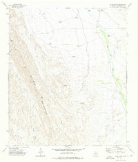
1972 · Cedar Arroyo
USGS Topo · 1:24,000
1984 · Indian Hot Springs
USGS Topo · 1:100,000
1993 · Indian Hot Springs
USGS Topo · 1:100,000