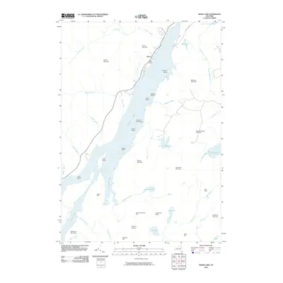
2010 Map of Indian Lake
USGS Topo · Published 2010About this map
The settlement of Sabael serves as the primary outpost on the western shore of Indian Lake, where Lakeshore Dr skirts the water's edge below Porter Mountain. This Central Adirondack landscape is defined by the elongated reach of the lake, which stretches north toward the The Narrows and Lake Abanakee. The shoreline is heavily articulated with points and islands, including Kirpens Island, Doherty Island, and Camp Island, while the surrounding terrain is dominated by prominent peaks such as Moose Mountain and Crotched Pond Mountain. To the south and east, the drainage network becomes intricate, featuring John Mack Pond and the Kunjamuk River. Local travel is marked by narrow corridors like Jerry Savarie Rd and Pratt Rd, which navigate the steep rises of Birch Hill and Baldface Mountain, illustrating the region's enduring character as a high-elevation wilderness area.
Find a feature on this map
52 named features on this map. Tap any name to fly to it.
Don’t see what you’re looking for? This feature index may not catch every label — zoom into the map to look around manually.
Map Details
Editions of this 2010 Indian Lake Map
This is the sole edition of this map. No revisions or reprints were ever made.
Other maps of this area

1898 · Newcomb
USGS Topo · 1:62,500

1898 · Thirteenth Lake
USGS Topo · 1:62,500

1899 · Indian Lake
USGS Topo · 1:62,500

1901 · Newcomb
USGS Topo · 1:62,500

1902 · Indian Lake
USGS Topo · 1:62,500

1903 · Blue Mountain
USGS Topo · 1:62,500

1950 · Utica
USGS Topo · 1:250,000

1954 · Newcomb
USGS Topo · 1:62,500

1954 · Thirteenth Lake
USGS Topo · 1:62,500

1954 · Blue Mountain
USGS Topo · 1:62,500