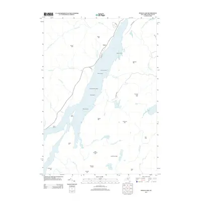
2013 Map of Indian Lake
USGS Topo · Published 2013About this map
Lewey Lake and the surrounding Adirondack highlands dominate this 2013 landscape, where the settlement of Sabael serves as a lone hub of habitation along the western shore. The water's character is defined by a series of named landforms including Kirpens Island, Doherty Island, and Camp Island, while the rugged verticality of the region is traced through peaks like Porter Mtn and Moose Mtn. This modern survey reveals a network of brooks and smaller basins like Crotched Pond and John Mack Pond that drain the timbered slopes. The road system, including Lakeshore Dr and Jerry Savarie Rd, indicates the established paths of travel that follow the natural contours of the lake and its neighboring ridges like Long Pond Ridge.
Find a feature on this map
48 named features on this map. Tap any name to fly to it.
Don’t see what you’re looking for? This feature index may not catch every label — zoom into the map to look around manually.
Map Details
Editions of this 2013 Indian Lake Map
This is the sole edition of this map. No revisions or reprints were ever made.
Other maps of this area

1898 · Newcomb
USGS Topo · 1:62,500

1898 · Thirteenth Lake
USGS Topo · 1:62,500

1899 · Indian Lake
USGS Topo · 1:62,500

1901 · Newcomb
USGS Topo · 1:62,500

1902 · Indian Lake
USGS Topo · 1:62,500

1903 · Blue Mountain
USGS Topo · 1:62,500

1950 · Utica
USGS Topo · 1:250,000

1954 · Newcomb
USGS Topo · 1:62,500

1954 · Thirteenth Lake
USGS Topo · 1:62,500

1954 · Blue Mountain
USGS Topo · 1:62,500