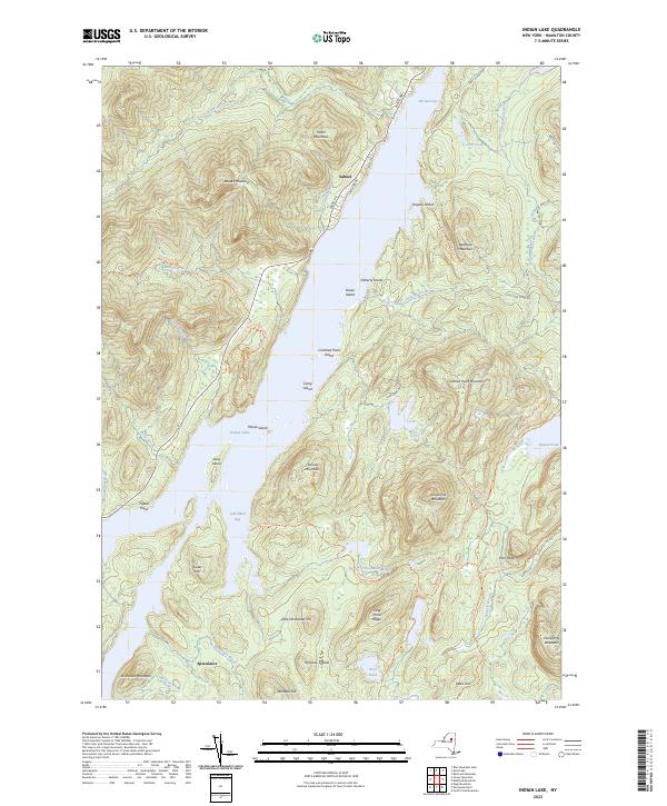
2023 Map of Indian Lake
USGS Topo · Published 2023About this map
Indian Lake dominates the central landscape of this Hamilton County region, serving as the focal point for the lakeside settlements of Sabael and Speculator. The water is dotted with significant landforms including Moose Island, Long Island, and Crotched Pond Island, while the surrounding terrain is defined by a series of prominent peaks and ridgelines. High elevations like Beaver Mountain, Porter Mountain, and Kunjamuk Mountain frame the deep valleys of John Mack Bay and The Narrows.
Find a feature on this map
61 named features on this map. Tap any name to fly to it.
Don’t see what you’re looking for? This feature index may not catch every label — zoom into the map to look around manually.
Map Details
Editions of this 2023 Indian Lake Map
This is the sole edition of this map. No revisions or reprints were ever made.
Other maps of this area

1898 · Newcomb
USGS Topo · 1:62,500

1898 · Thirteenth Lake
USGS Topo · 1:62,500

1899 · Indian Lake
USGS Topo · 1:62,500

1901 · Newcomb
USGS Topo · 1:62,500

1902 · Indian Lake
USGS Topo · 1:62,500

1903 · Blue Mountain
USGS Topo · 1:62,500

1950 · Utica
USGS Topo · 1:250,000

1954 · Newcomb
USGS Topo · 1:62,500

1954 · Thirteenth Lake
USGS Topo · 1:62,500

1954 · Blue Mountain
USGS Topo · 1:62,500