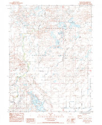
1985 Map of Indian Lakes
USGS Topo · Published 1985About this map
The Stillwater Wildlife Management Area dominates this portion of the Lahonton Valley, where the intricate hydrology of the Carson River basin is managed through an extensive network of canals and drains. This 1985 survey illustrates the complex water distribution systems essential to this arid region, featuring structures like Wolf Dam and the Ságouspe Dam. The landscape is defined by the Indian Lakes chain, including Big Indian Lake, Papoose Lake, and Likes Lake.
Find a feature on this map
33 named features on this map. Tap any name to fly to it.
Don’t see what you’re looking for? This feature index may not catch every label — zoom into the map to look around manually.
Map Details
Editions of this 1985 Indian Lakes Map
This is the sole edition of this map. No revisions or reprints were ever made.
Other maps of this area

1908 · Carson Sink
USGS Topo · 1:250,000

1910 · Carson Sink
USGS Topo · 1:250,000

1950 · Stillwater
USGS Topo · 1:62,500

1951 · Carson Lake
USGS Topo · 1:62,500

1951 · Soda Lake
USGS Topo · 1:62,500

1951 · Fallon
USGS Topo · 1:62,500

1957 · Reno
USGS Topo · 1:250,000

1959 · Reno
USGS Topo · 1:250,000

1960 · Reno
USGS Topo · 1:250,000

1979 · Carson Sink
USGS Topo · 1:100,000