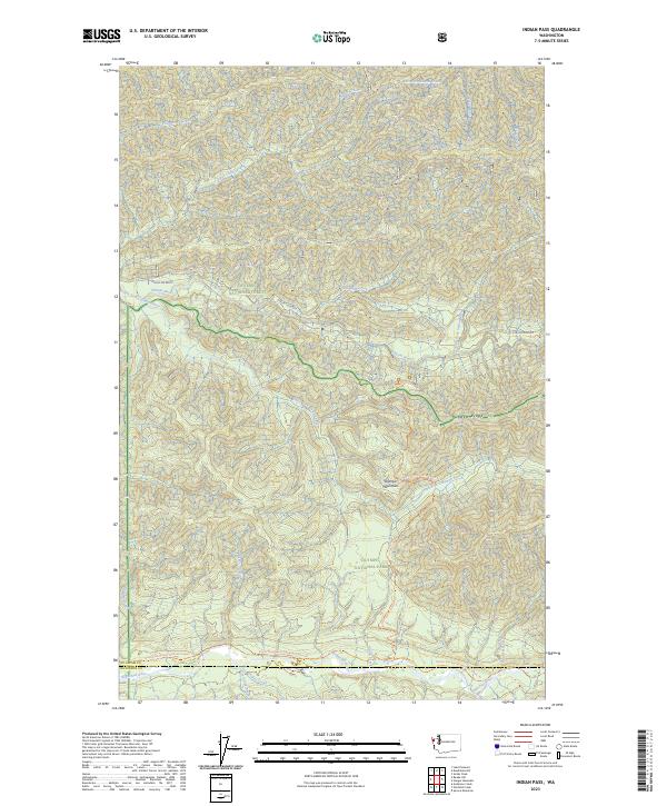
2023 Map of Indian Pass
USGS Topo · Published 2023About this map
The Olympic Mountains dominate this high-elevation terrain where the headwaters of several major river systems originate. The map documents a complex protected landscape, illustrating the boundaries where Olympic National Forest meets the strictly preserved Olympic National Park and the even more remote Olympic Wilderness. Water is the defining feature of the topography, with the Sitkum River and South Fork Calawah River carving deep drainage patterns across the northern and central sections. To the south, the Bogachiel River flows near the county line, joined by tributaries like Boulevard Creek. Recreational and transport infrastructure is limited to significant corridors like the Pacific Northwest National Scenic Trl and the Sitkum Soleduck route, highlighting the area's role as a preserved natural sanctuary near Rugged Ridge.
Find a feature on this map
32 named features on this map. Tap any name to fly to it.
Don’t see what you’re looking for? This feature index may not catch every label — zoom into the map to look around manually.
Map Details
Editions of this 2023 Indian Pass Map
This is the sole edition of this map. No revisions or reprints were ever made.
Other maps of this area

1922 · Pysht
USGS Topo · 1:62,500

1935 · Lake Pleasant
USGS Topo · 1:62,500

1939 · Forks
USGS Topo · 1:62,500

1942 · Pysht
USGS Topo · 1:62,500

1942 · Lake Pleasant
USGS Topo · 1:62,500

1943 · Spruce Mountain
USGS Topo · 1:62,500

1943 · Copalis Beach
USGS Topo · 1:250,000

1951 · Copalis Beach
USGS Topo · 1:250,000

1953 · Cape Flattery
USGS Topo · 1:250,000

1956 · Spruce Mtn.
USGS Topo · 1:62,500