
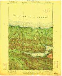
1943 Map of Spruce Mountain
USGS Topo · Published 1943About this map
Hoh River homesteads and remote forest outposts define this 1943 topographical study produced by the U.S. Army Corps of Engineers. The landscape is characterized by the river systems of the Bogachiel River, Calawah River, and Sitkum River, which carve through the dense terrain of the Olympic National Forest. Throughout the Upper Hoh Valley, established family holdings such as the Schmidt Ranch, Snell Ranch, and Huelsdonk Ranch mark the limited extent of private settlement in this wilderness.
Find a feature on this map
54 named features on this map. Tap any name to fly to it.
Don’t see what you’re looking for? This feature index may not catch every label — zoom into the map to look around manually.
Map Details
Editions of this 1943 Spruce Mountain Map
This is the sole edition of this map. No revisions or reprints were ever made.
Other maps of this area

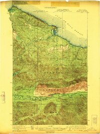
1918 · Lake Crescent
USGS Topo · 1:62,500
1922 · Pysht
USGS Topo · 1:62,500
1922 · Lake Crescent
USGS Topo · 1:62,500

1935 · Lake Pleasant
USGS Topo · 1:62,500
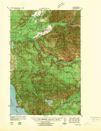
1939 · Forks
USGS Topo · 1:62,500

1939 · Mount Tom
USGS Topo · 1:62,500

1942 · Pysht
USGS Topo · 1:62,500

1942 · Lake Pleasant
USGS Topo · 1:62,500

1943 · Copalis Beach
USGS Topo · 1:250,000
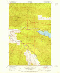
1950 · Mount Muller
USGS Topo · 1:24,000