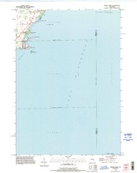
1992 Map of Indian Point
USGS Topo · Published 1996About this map
Lake Winnebago dominates this 1990s survey, showing the intricate shoreline where the townships of Vinland and Oshkosh meet the water. The map details a series of distinct landforms along the western coast, including Indian Point, Jenkyns Point, and Perkins Point, which create sheltered inlets like Cowling Bay and North Asylum Bay. This era of the landscape is marked by lakeside residential development and recreational infrastructure, notably the Osh-O-Nee Midway Boat Ramp and numerous private piers.
Find a feature on this map
23 named features on this map. Tap any name to fly to it.
Don’t see what you’re looking for? This feature index may not catch every label — zoom into the map to look around manually.
Map Details
Editions of this 1992 Indian Point Map
This is the sole edition of this map. No revisions or reprints were ever made.
Other maps of this area

1910 · Fond du Lac
USGS Topo · 1:62,500

1911 · Neenah
USGS Topo · 1:62,500

1955 · Neenah
USGS Topo · 1:62,500

1955 · Neenah
USGS Topo · 1:24,000

1955 · Fond Du Lac
USGS Topo · 1:62,500

1955 · Green Bay
USGS Topo · 1:250,000

1956 · Rosendale
USGS Topo · 1:62,500

1957 · Madison
USGS Topo · 1:250,000

1960 · Madison
USGS Topo · 1:250,000

1961 · Oshkosh
USGS Topo · 1:24,000