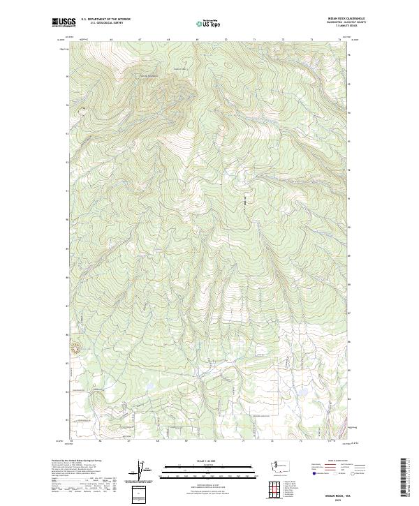
2023 Map of Indian Rock
USGS Topo · Published 2023About this map
The Simcoe Mountains dominate this high-elevation landscape in Klickitat County, reaching a topographic peak at Indian Rock. This survey documents a complex network of seasonal and perennial water sources, including the headwaters of the West Prong Little Klickitat River and the isolated Pothole Lake near Devils Canyon. The southern portion of the quadrangle reveals a distinctive naming pattern for local infrastructure, with roads like Goldenpine, Wild Apple, and Noble Fir suggesting the area's transition into forested foothills. Historically significant water features like Morehead Spring and Cozy Nook Creek highlight the importance of water management in this high-country environment. The map also identifies numerous utilitarian routes, some noted specifically as Impassable, reflecting the difficult terrain of the region.
Find a feature on this map
41 named features on this map. Tap any name to fly to it.
Don’t see what you’re looking for? This feature index may not catch every label — zoom into the map to look around manually.
Map Details
Editions of this 2023 Indian Rock Map
This is the sole edition of this map. No revisions or reprints were ever made.
Other maps of this area

1937 · White Swan
USGS Topo · 1:125,000

1950 · Yakima
USGS Topo · 1:250,000

1953 · The Dalles
USGS Topo · 1:250,000

1956 · The Dalles
USGS Topo · 1:250,000

1957 · The Dalles
USGS Topo · 1:250,000

1957 · Goldendale
USGS Topo · 1:62,500

1957 · Satus Pass
USGS Topo · 1:62,500

1958 · Yakima
USGS Topo · 1:250,000

1961 · Yakima
USGS Topo · 1:250,000
1965 · Logy Creek
USGS Topo · 1:62,500