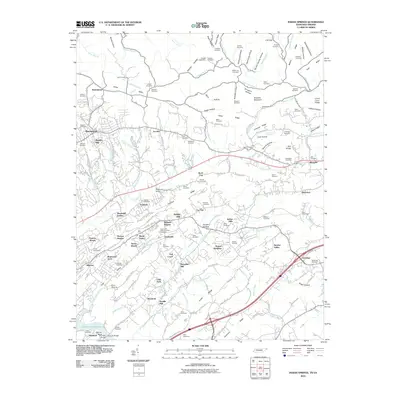
2010 Map of Indian Springs
USGS Topo · Published 2010About this map
Indian Springs and the surrounding residential developments of Sullivan County represent a landscape of modern expansion deeply rooted in historical family tracts. The terrain is defined by a series of parallel ridges, including Latture Ridge and Chestnut Ridge, which channel waterways like Reedy Creek and Fall Creek. Genealogists will find a high density of burial sites across these valleys, from the larger East Lawn Memorial Park Cemetery to smaller family plots such as Vineyard Cemetery, Fain Cemetery, and Hensley Cemetery. Evidence of the area's agricultural and industrial past is visible in landmarks like Pettyjohn Mill and Huddle Mill, along with several historic crossings such as Anderson Bridge and Hemlock Bridge. The map captures the suburban growth of Kingsley Hills, Thomas Heights, and Bridwell Heights as they fill the spaces between long-established settlements like Arcadia and Bloomingdale.
Find a feature on this map
152 named features on this map. Tap any name to fly to it.
Don’t see what you’re looking for? This feature index may not catch every label — zoom into the map to look around manually.
Map Details
Editions of this 2010 Indian Springs Map
This is the sole edition of this map. No revisions or reprints were ever made.
Other maps of this area

1891 · Roan Mountain
USGS Topo · 1:125,000

1892 · Greeneville
USGS Topo · 1:125,000

1894 · Roan Mountain
USGS Topo · 1:125,000

1894 · Estillville
USGS Topo · 1:125,000

1896 · Greeneville
USGS Topo · 1:125,000

1897 · Bristol
USGS Topo · 1:125,000

1902 · Bristol
USGS Topo · 1:125,000

1904 · Roan Mountain
USGS Topo · 1:125,000

1904 · Greeneville
USGS Topo · 1:125,000

1935 · Hilton
USGS Topo · 1:24,000