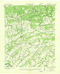
1935 Map of Indian Springs
USGS Topo · Published 1935About this map
Chestnut Ridge divides this Appalachian landscape during a period of significant local development in the mid-1930s. The region is defined by a dense network of country schools and churches that served rural Tennessee and Virginia families, including the Gunnings Academy and Bancroft Memorial Ch. Early industrial activity is visible along the watercourses, where the Pettyjohn Mill and Huddle Mill utilized local branches, and a Mill Dam sits near Silvicola.
Find a feature on this map
59 named features on this map. Tap any name to fly to it.
Don’t see what you’re looking for? This feature index may not catch every label — zoom into the map to look around manually.
Map Details
Editions of this 1935 Indian Springs Map
This is the sole edition of this map. No revisions or reprints were ever made.
Other maps of this area

1891 · Roan Mountain
USGS Topo · 1:125,000

1892 · Greeneville
USGS Topo · 1:125,000

1894 · Roan Mountain
USGS Topo · 1:125,000

1894 · Estillville
USGS Topo · 1:125,000

1896 · Greeneville
USGS Topo · 1:125,000

1897 · Bristol
USGS Topo · 1:125,000

1902 · Bristol
USGS Topo · 1:125,000

1904 · Roan Mountain
USGS Topo · 1:125,000

1904 · Greeneville
USGS Topo · 1:125,000

1935 · Hilton
USGS Topo · 1:24,000