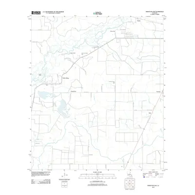
2012 Map of Indian Village
USGS Topo · Published 2012About this map
The Calcasieu River meanders through this portion of Allen Parish, defining a landscape of wetlands and river bluffs. Settled points of interest follow the high ground along the water, including Phillips Bluff, Lormand Bluff, and Nevils Bluff. The namesake Indian Village sits near the Indian Cutoff, reflecting the historical river-oriented development of the region. Local genealogy is anchored by the Nevil Cem and small settlements like Gravel Point, Edna, and Fontenot. Beyond the river banks, the interior is shaped by industrial energy extraction, marked by the North Indian Village Gas Field and the Southwest Kinder Gas Field. The road network, with names like Old Ferry Rd and Martin Tram Rd, hints at earlier eras of river crossings and timber transport.
Find a feature on this map
54 named features on this map. Tap any name to fly to it.
Don’t see what you’re looking for? This feature index may not catch every label — zoom into the map to look around manually.
Map Details
Editions of this 2012 Indian Village Map
This is the sole edition of this map. No revisions or reprints were ever made.
Other maps of this area

1947 · Kinder
USGS Topo · 1:31,680

1947 · Fenton
USGS Topo · 1:31,680

1947 · Oberlin
USGS Topo · 1:31,680

1947 · Hecker
USGS Topo · 1:31,680

1947 · Pine Island
USGS Topo · 1:31,680

1947 · Le Blanc
USGS Topo · 1:31,680

1947 · Edna
USGS Topo · 1:31,680

1947 · Reeves
USGS Topo · 1:31,680

1947 · Thompson Bluff
USGS Topo · 1:31,680

1950 · Fenton
USGS Topo · 1:31,680