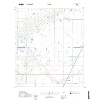
2018 Map of Indian Village
USGS Topo · Published 2018About this map
The Calcasieu River defines the upper portion of this southwest Louisiana landscape, winding past a series of named riverside bluffs such as Phillips Bluff, Nevils Bluff, and Lormand Bluff. This 2018 survey captures the interface of Allen and Jefferson Davis parishes, characterized by the dense network of bayous and gullies that drain the low-lying prairie and timberland. The small settlement of Indian Village and the historic Nevil Cem serve as key landmarks for local researchers, while the winding Bayou Serpent and Bunchs Cr crisscross the central wetlands.
Find a feature on this map
54 named features on this map. Tap any name to fly to it.
Don’t see what you’re looking for? This feature index may not catch every label — zoom into the map to look around manually.
Map Details
Editions of this 2018 Indian Village Map
This is the sole edition of this map. No revisions or reprints were ever made.
Other maps of this area

1947 · Kinder
USGS Topo · 1:31,680

1947 · Fenton
USGS Topo · 1:31,680

1947 · Oberlin
USGS Topo · 1:31,680

1947 · Hecker
USGS Topo · 1:31,680

1947 · Pine Island
USGS Topo · 1:31,680

1947 · Le Blanc
USGS Topo · 1:31,680

1947 · Edna
USGS Topo · 1:31,680

1947 · Reeves
USGS Topo · 1:31,680

1947 · Thompson Bluff
USGS Topo · 1:31,680

1950 · Fenton
USGS Topo · 1:31,680