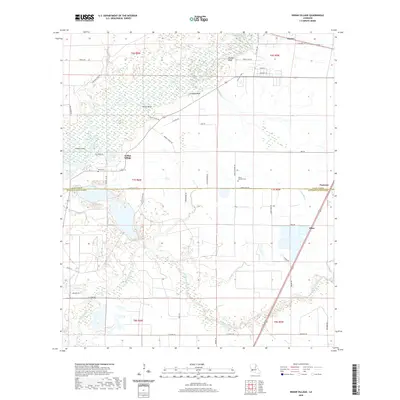
2020 Map of Indian Village
USGS Topo · Published 2020About this map
The Calcasieu River meanders through this portion of Allen Parish, defining a landscape marked by prominent riverbank elevations such as Phillips Bluff, Nevils Bluff, and Lormand Bluff. In 2020, the settlement of Indian Village remains a focal point near the river's edge, positioned just north of the Allen Parish and Jefferson Davis Parish line. This boundary is further delineated by Parish Line Rd, which cuts across the central portion of the map, separating the northern settlements from southern points like Edna.
Find a feature on this map
53 named features on this map. Tap any name to fly to it.
Don’t see what you’re looking for? This feature index may not catch every label — zoom into the map to look around manually.
Map Details
Editions of this 2020 Indian Village Map
This is the sole edition of this map. No revisions or reprints were ever made.
Other maps of this area

1947 · Kinder
USGS Topo · 1:31,680

1947 · Fenton
USGS Topo · 1:31,680

1947 · Oberlin
USGS Topo · 1:31,680

1947 · Hecker
USGS Topo · 1:31,680

1947 · Pine Island
USGS Topo · 1:31,680

1947 · Le Blanc
USGS Topo · 1:31,680

1947 · Edna
USGS Topo · 1:31,680

1947 · Reeves
USGS Topo · 1:31,680

1947 · Thompson Bluff
USGS Topo · 1:31,680

1950 · Fenton
USGS Topo · 1:31,680