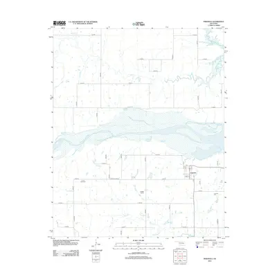
2012 Map of Indianola
USGS Topo · Published 2012About this map
Indianola serves as the primary hub of this Pittsburg County landscape, situated just south of the expansive waters of Eufaula Lake. The town's grid is clearly defined by local streets such as Pearl St and 1st St, with the Indianola Cem marking the eastern periphery. The terrain to the west opens into Choate Prairie, a distinct geographic area that retains its identity through its own namesake Choate Prairie Cem and a small collection of structures near the junction of Choate Prairie Rd.
Find a feature on this map
40 named features on this map. Tap any name to fly to it.
Don’t see what you’re looking for? This feature index may not catch every label — zoom into the map to look around manually.
Map Details
Editions of this 2012 Indianola Map
This is the sole edition of this map. No revisions or reprints were ever made.
Other maps of this area

1900 · Canadian
USGS Topo · 1:125,000

1946 · Fort Smith
USGS Topo · 1:250,000

1962 · Raiford
USGS Topo · 1:24,000

1962 · Henryetta SW
USGS Topo · 1:24,000

1963 · Stidham
USGS Topo · 1:24,000

1965 · Fort Smith
USGS Topo · 1:250,000

1967 · Fort Smith
USGS Topo · 1:250,000
1971 · Crowder
USGS Topo · 1:24,000
1971 · Canadian
USGS Topo · 1:24,000
1971 · Lake Mc Alester
USGS Topo · 1:24,000