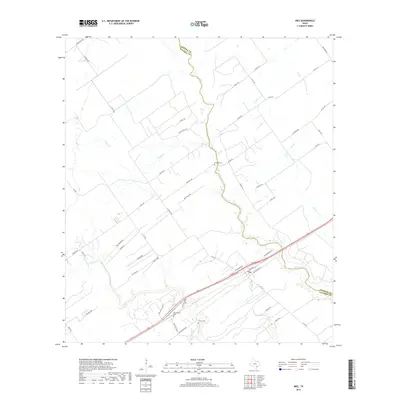
2019 Map of Inez
USGS Topo · Published 2019About this map
Arenosa Cr and Garcitas Cr wind through the coastal prairie along the border of Jackson and Victoria Counties. This 2019 survey documents a landscape of large-scale ranching and agriculture, characterized by long, straight thoroughfares like J-2 Ranch Rd and Nickel Ranch Rd. Small family-named landmarks and rural burial sites provide significant genealogical value, including Bischoff Cem located north of the creek crossing and Hirchhauser Cem near the southern edge of the map. The distribution of rural homesteads and access points such as Gentry Rd and Bischoff Rd reflects the long-standing land divisions in this part of Texas. Modern infrastructure, including the FM 444 corridor and Holzhauser Rd, connects these remote ranch lands to the surrounding regional network.
Find a feature on this map
49 named features on this map. Tap any name to fly to it.
Don’t see what you’re looking for? This feature index may not catch every label — zoom into the map to look around manually.
Map Details
Editions of this 2019 Inez Map
This is the sole edition of this map. No revisions or reprints were ever made.
Other maps of this area

1951 · Inez NW
USGS Topo · 1:24,000

1951 · Inez
USGS Topo · 1:24,000

1952 · Edna
USGS Topo · 1:24,000

1952 · La Salle
USGS Topo · 1:24,000

1952 · Marcado Creek
USGS Topo · 1:24,000

1952 · Victoria East
USGS Topo · 1:24,000

1953 · Beeville
USGS Topo · 1:250,000

1953 · Seguin
USGS Topo · 1:250,000

1956 · Beeville
USGS Topo · 1:250,000

1958 · Seguin
USGS Topo · 1:250,000