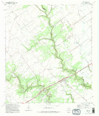
1995 Map of Inez
USGS Topo · Published 1995About this map
The town of Inez serves as the focal point of this coastal prairie landscape, situated near the boundary line separating Jackson and Victoria counties. In the mid-1990s, the area's development was defined by the intersection of the Southern Pacific railroad and local waterways like Arenosa Creek and Garcitas Creek. The presence of several family-named burial sites, including Bishoff Cem, Hirchhauser Cem, and Farrer Cem, suggests a long-standing agricultural and ranching heritage.
Find a feature on this map
20 named features on this map. Tap any name to fly to it.
Don’t see what you’re looking for? This feature index may not catch every label — zoom into the map to look around manually.
Map Details
Editions of this 1995 Inez Map
This is the sole edition of this map. No revisions or reprints were ever made.
Other maps of this area

1951 · Inez NW
USGS Topo · 1:24,000

1951 · Inez
USGS Topo · 1:24,000

1952 · Edna
USGS Topo · 1:24,000

1952 · La Salle
USGS Topo · 1:24,000

1952 · Marcado Creek
USGS Topo · 1:24,000

1952 · Victoria East
USGS Topo · 1:24,000

1953 · Beeville
USGS Topo · 1:250,000

1953 · Seguin
USGS Topo · 1:250,000

1956 · Beeville
USGS Topo · 1:250,000

1958 · Seguin
USGS Topo · 1:250,000