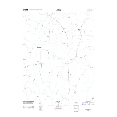
2013 Map of Ingleside
USGS Topo · Published 2013About this map
Ingleside and the surrounding rural landscape of Franklin County are defined by a complex network of small creeks and family-named roads. This area south of the Virginia border is dominated by the westward-flowing Tar River, which forms a prominent curve near the Simms Bridge crossing. The settlement pattern is characterized by widely dispersed hamlets such as Rocky Ford, Epsom, and Moulton, connected by a web of local routes including Sollie Ayscue Rd and Joe Ward Rd, reflecting generations of land ownership.
Find a feature on this map
89 named features on this map. Tap any name to fly to it.
Don’t see what you’re looking for? This feature index may not catch every label — zoom into the map to look around manually.
Map Details
Editions of this 2013 Ingleside Map
This is the sole edition of this map. No revisions or reprints were ever made.
Other maps of this area

1953 · Greensboro
USGS Topo · 1:250,000

1954 · Greensboro
USGS Topo · 1:250,000

1962 · Greensboro
USGS Topo · 1:250,000

1966 · Greensboro
USGS Topo · 1:250,000

1970 · Vicksboro
USGS Topo · 1:24,000

1970 · Henderson
USGS Topo · 1:24,000

1971 · Afton
USGS Topo · 1:24,000
1978 · Franklinton
USGS Topo · 1:24,000
1978 · Gold Sand
USGS Topo · 1:24,000
1978 · Louisburg
USGS Topo · 1:24,000