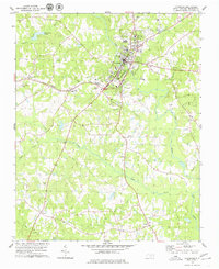
1978 Map of Louisburg
USGS Topo · Published 1979About this map
Louisburg sits as the central hub of this late-1970s landscape, positioned where the Tar River meets a network of local transport and education. The town's historic character is anchored by Louisburg College and the High School, while the presence of the Armory, Fairgrounds, and a Drive-in Theatre reflects the mid-century civic and social infrastructure of Franklin County. Beyond the town center, the Seaboard Coast Line railroad cuts across the terrain, linking the smaller community of Katesville and the Franklin County Airport to the wider region.
Find a feature on this map
39 named features on this map. Tap any name to fly to it.
Don’t see what you’re looking for? This feature index may not catch every label — zoom into the map to look around manually.
Map Details
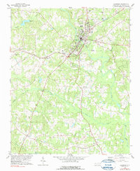
Editions of this 1978 Louisburg Map
2 editions found
Other maps of this area

1902 · Spring Hope
USGS Topo · 1:62,500

1904 · Springhope
USGS Topo · 1:62,500

1953 · Raleigh
USGS Topo · 1:250,000

1953 · Greensboro
USGS Topo · 1:250,000

1954 · Greensboro
USGS Topo · 1:250,000

1954 · Raleigh
USGS Topo · 1:250,000

1962 · Greensboro
USGS Topo · 1:250,000

1966 · Greensboro
USGS Topo · 1:250,000
1967 · Rolesville
USGS Topo · 1:24,000

1968 · Bunn West
USGS Topo · 1:24,000