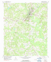
1978 Map of Louisburg
USGS Topo · Published 1990About this map
Louisburg sits at a prominent bend in the Tar River, serving as a cultural and educational hub anchored by the campus of Louisburg College. This late-1970s landscape shows the town's expansion with established infrastructure like the Franklin County Airport and the Seaboard Coast Line railroad passing through Katesville. The surrounding terrain is defined by a dense network of tributaries including Buffalo Creek, Cedar Creek, and Wolfpen Branch, which drain the varied topography into the primary river valley.
Find a feature on this map
39 named features on this map. Tap any name to fly to it.
Don’t see what you’re looking for? This feature index may not catch every label — zoom into the map to look around manually.
Map Details
Editions of this 1978 Louisburg Map
2 editions found
Other maps of this area

1902 · Spring Hope
USGS Topo · 1:62,500

1904 · Springhope
USGS Topo · 1:62,500

1953 · Raleigh
USGS Topo · 1:250,000

1953 · Greensboro
USGS Topo · 1:250,000

1954 · Greensboro
USGS Topo · 1:250,000

1954 · Raleigh
USGS Topo · 1:250,000

1962 · Greensboro
USGS Topo · 1:250,000

1966 · Greensboro
USGS Topo · 1:250,000
1967 · Rolesville
USGS Topo · 1:24,000

1968 · Bunn West
USGS Topo · 1:24,000