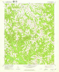
1979 Map of Ingleside
USGS Topo · Published 1979About this map
Epsom and Ingleside serve as the primary rural hubs for this pocket of North Carolina, situated along the county line between Vance and Franklin counties. The landscape is defined by the winding course of the Tar River at the southern boundary, where it is joined by Buffalo Creek and Bear Creek. The community layout reflects a traditional rural structure centered on local gathering places, with several country churches including New Bethel Ch, Mitchell Ch, and Rolling Chapel spread across the township. For those interested in early aviation or local education, the presence of the Ball Airport and its accompanying Landing Strip, alongside the Franklin Academy, provides a look at the mid-to-late 20th-century infrastructure. Numerous small watercourses, such as Devils Cradle Creek and Lynch Creek, carve through the terrain, illustrating the natural drainage patterns that have shaped the region's agriculture and road development.
Find a feature on this map
28 named features on this map. Tap any name to fly to it.
Don’t see what you’re looking for? This feature index may not catch every label — zoom into the map to look around manually.
Map Details
Editions of this 1979 Ingleside Map
This is the sole edition of this map. No revisions or reprints were ever made.
Other maps of this area

1953 · Greensboro
USGS Topo · 1:250,000

1954 · Greensboro
USGS Topo · 1:250,000

1962 · Greensboro
USGS Topo · 1:250,000

1966 · Greensboro
USGS Topo · 1:250,000

1970 · Vicksboro
USGS Topo · 1:24,000

1970 · Henderson
USGS Topo · 1:24,000

1971 · Afton
USGS Topo · 1:24,000
1978 · Franklinton
USGS Topo · 1:24,000
1978 · Gold Sand
USGS Topo · 1:24,000
1978 · Louisburg
USGS Topo · 1:24,000