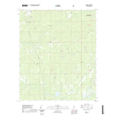
2021 Map of Ingram
USGS Topo · Published 2021About this map
Harper Hill and the surrounding Hale County countryside are defined by a high density of rural burial grounds, reflecting generations of family settlement in this corner of Alabama. Numerous named cemeteries such as Saint Johns Cem, Rhodes Chapel Cem, and Pruitt Springs Cem are scattered across the landscape, often situated near local churches or established homesteads. The terrain is marked by the winding courses of Fivemile Cr and Big Brush Cr, which carve through the wooded hillsides.
Find a feature on this map
63 named features on this map. Tap any name to fly to it.
Don’t see what you’re looking for? This feature index may not catch every label — zoom into the map to look around manually.
Map Details
Editions of this 2021 Ingram Map
This is the sole edition of this map. No revisions or reprints were ever made.
Other maps of this area

1953 · Montgomery
USGS Topo · 1:250,000

1956 · Montgomery
USGS Topo · 1:250,000

1957 · Montgomery
USGS Topo · 1:250,000

1979 · Morgan Springs
USGS Topo · 1:24,000

1979 · Greensboro
USGS Topo · 1:24,000

1980 · Payne Lake
USGS Topo · 1:24,000

1980 · Ingram
USGS Topo · 1:24,000
1980 · Moundville West
USGS Topo · 1:24,000
1980 · Sawyerville
USGS Topo · 1:24,000
1980 · Hogglesville
USGS Topo · 1:24,000