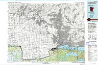
1978 Map of International Falls
USGS Topo · Published 1993About this map
International Falls serves as the primary gateway to the borderlands of northern Minnesota, anchored by the vast waters of Rainy Lake and the winding course of the Rainy River. This survey captures the transition of the region’s timber and transport economy into the late 20th century, notably showing the early footprint of Voyageurs National Park and the extensive Smokey Bear State Forest. The settlement pattern follows the river, with South International Falls and Ranier established at the lake’s outlet, while the Duluth Winnipeg and Pacific railroad provides a critical link for the pulp and paper industries that defined the era.
Find a feature on this map
51 named features on this map. Tap any name to fly to it.
Don’t see what you’re looking for? This feature index may not catch every label — zoom into the map to look around manually.
Map Details
Editions of this 1978 International Falls Map
This is the sole edition of this map. No revisions or reprints were ever made.
Other maps of this area

1919 · Pelland
USGS Topo · 1:62,500

1919 · Birchdale
USGS Topo · 1:62,500

1919 · I
USGS Topo · 1:62,500

1919 · Happy Land
USGS Topo · 1:62,500

1919 · International Falls
USGS Topo · 1:62,500

1943 · Lindford
USGS Topo · 1:62,500

1954 · Roseau
USGS Topo · 1:250,000

1954 · International Falls
USGS Topo · 1:250,000

1957 · Roseau
USGS Topo · 1:250,000

1957 · International Falls
USGS Topo · 1:250,000