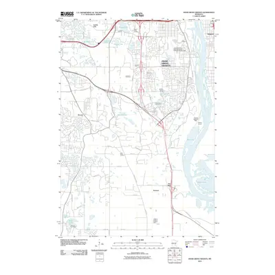
2010 Map of Inver Grove Heights
USGS Topo · Published 2010About this map
Inver Grove Heights and the surrounding Dakota County landscape are defined here by a dense network of suburban development and industrial infrastructure along the Mississippi River. This 2010 survey shows the area's transition from residential clusters near Sunfish Lake to the riverfront activity at Roseport and Pine Bend. Genealogists will find several notable burial grounds, including Saint Patrick Cemetery, Salem Kirche Cemetery, and Union Cemetery, which speak to the area's long-established communities. Aviation and industry are central to the river corridor, anchored by the South Saint Paul Municipal Airport-Richard E Fleming Field and the specialized Wipline Seaplane Base. Between the developed corridors, recreational spaces like the Inverwood Golf Course and Arbor Pointe Golf Course provide buffer zones amidst the glacial lake topography of Marcott Lakes and Simley Lake.
Find a feature on this map
65 named features on this map. Tap any name to fly to it.
Don’t see what you’re looking for? This feature index may not catch every label — zoom into the map to look around manually.
Map Details
Editions of this 2010 Inver Grove Heights Map
This is the sole edition of this map. No revisions or reprints were ever made.
Other maps of this area

1896 · St. Paul
USGS Topo · 1:62,500

1946 · Hudson
USGS Topo · 1:62,500

1949 · Hudson
USGS Topo · 1:62,500

1949 · Lake Elmo
USGS Topo · 1:24,000

1950 · Lake Elmo
USGS Topo · 1:24,000

1950 · St Paul Park
USGS Topo · 1:24,000

1951 · St Paul Park
USGS Topo · 1:24,000

1951 · St. Paul West
USGS Topo · 1:24,000

1951 · Inver Grove
USGS Topo · 1:24,000

1951 · St. Paul SW
USGS Topo · 1:24,000