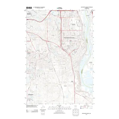
2013 Map of Inver Grove Heights
USGS Topo · Published 2013About this map
The Mississippi River corridor shapes the eastern edge of this suburban landscape, where the communities of Inver Grove Heights, Eagan, and Mendota Heights meet. Large-scale infrastructure projects including the South St Paul Municipal Airport-Richard E Fleming Field and the Wipline Airport suggest the area's role as a regional transit and aviation hub. Inland, the terrain is dotted with numerous small glacial lakes such as Marcott Lakes, Sunfish Lake, and Hornbeam Lake.
Find a feature on this map
176 named features on this map. Tap any name to fly to it.
Don’t see what you’re looking for? This feature index may not catch every label — zoom into the map to look around manually.
Map Details
Editions of this 2013 Inver Grove Heights Map
This is the sole edition of this map. No revisions or reprints were ever made.
Other maps of this area

1896 · St. Paul
USGS Topo · 1:62,500

1946 · Hudson
USGS Topo · 1:62,500

1949 · Hudson
USGS Topo · 1:62,500

1949 · Lake Elmo
USGS Topo · 1:24,000

1950 · Lake Elmo
USGS Topo · 1:24,000

1950 · St Paul Park
USGS Topo · 1:24,000

1951 · St Paul Park
USGS Topo · 1:24,000

1951 · St. Paul West
USGS Topo · 1:24,000

1951 · Inver Grove
USGS Topo · 1:24,000

1951 · St. Paul SW
USGS Topo · 1:24,000