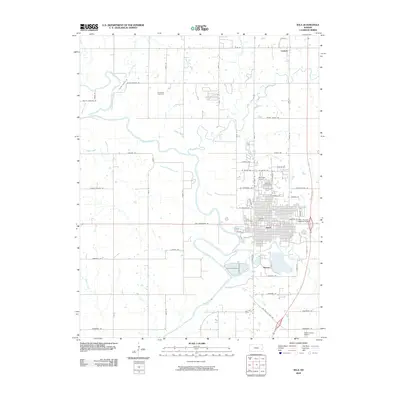
2009 Map of Iola
USGS Topo · Published 2009About this map
The Neosho River meanders through this portion of Allen County, anchoring the regional landscape and the development of Iola. This 2009 survey highlights a significant aviation and infrastructure footprint, featuring three distinct landing sites including Womack Airport, Allen County Hospital Airport, and the larger Allen County Airport to the south. The urban layout of Iola is clearly defined by a grid of named streets such as New Hampshire Rd and Kansas Ave, extending toward the smaller community of Bassett. Genealogists will find particular value in the clearly marked locations of Carpenter Cemetery, Highland Cemetery, and Iola Cemetery, which sit alongside the rural roads and tributaries like Deer Creek and Coon Creek that define the countryside north toward Carlyle.
Find a feature on this map
62 named features on this map. Tap any name to fly to it.
Don’t see what you’re looking for? This feature index may not catch every label — zoom into the map to look around manually.
Map Details
Editions of this 2009 Iola Map
This is the sole edition of this map. No revisions or reprints were ever made.
Other maps of this area

1885 · Burlington
USGS Topo · 1:125,000

1885 · Garnett
USGS Topo · 1:125,000

1886 · Fredonia
USGS Topo · 1:125,000

1886 · Iola
USGS Topo · 1:125,000

1893 · Iola
USGS Topo · 1:125,000

1894 · Garnett
USGS Topo · 1:125,000

1894 · Fredonia
USGS Topo · 1:125,000

1894 · Burlington
USGS Topo · 1:125,000

1904 · Iola
USGS Topo · 1:125,000

1947 · Lawrence
USGS Topo · 1:250,000