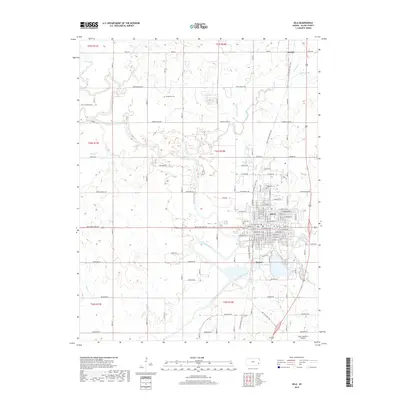
2018 Map of Iola
USGS Topo · Published 2018About this map
Neosho River meanders through the heart of this Allen County landscape, defining the geography of Iola and its neighbor Bassett. The city of Iola presents a dense grid of residential and commercial streets, including W Madison Ave and Broadway St, while the community of Carlyle anchors the northeastern portion of the sheet. For local historians and genealogists, the map identifies several significant burial grounds, such as Carpenter Cem to the north and Highland Cem within the city limits. The transition of the region's transport infrastructure is visible where the Prairie Spirit Rail Trail follows former railroad corridors through town. Natural features like the distinctive ridge known as the Backbone south of town and the waters of Lake Bassett provide a clear view of how the area's industrial and recreational footprint sits alongside the river's winding path.
Find a feature on this map
77 named features on this map. Tap any name to fly to it.
Don’t see what you’re looking for? This feature index may not catch every label — zoom into the map to look around manually.
Map Details
Editions of this 2018 Iola Map
This is the sole edition of this map. No revisions or reprints were ever made.
Other maps of this area

1885 · Burlington
USGS Topo · 1:125,000

1885 · Garnett
USGS Topo · 1:125,000

1886 · Fredonia
USGS Topo · 1:125,000

1886 · Iola
USGS Topo · 1:125,000

1893 · Iola
USGS Topo · 1:125,000

1894 · Garnett
USGS Topo · 1:125,000

1894 · Fredonia
USGS Topo · 1:125,000

1894 · Burlington
USGS Topo · 1:125,000

1904 · Iola
USGS Topo · 1:125,000

1947 · Lawrence
USGS Topo · 1:250,000