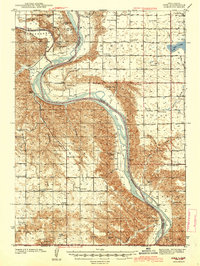
1944 Map of Iona
USGS Topo · Published 1944About this map
The Missouri River winds through this 1940s landscape, serving as a natural boundary between Brule and Lyman counties. This era of the river's history shows large riverine features like Bailey Island and Phillips Island before major mid-century dam projects altered the Missouri's flow. Along the northern edge, the White River joins the Missouri, framed by the plateau of Petersons.
Find a feature on this map
44 named features on this map. Tap any name to fly to it.
Don’t see what you’re looking for? This feature index may not catch every label — zoom into the map to look around manually.
Map Details
Editions of this 1944 Iona Map
2 editions found
Other maps of this area

1935 · Chamberlain
USGS Topo · 1:62,500

1939 · Chamberlain
USGS Topo · 1:62,500

1940 · Iona
USGS Topo · 1:62,500

1941 · Pukwana
USGS Topo · 1:62,500

1944 · Iona
USGS Topo · 1:62,500

1951 · Pukwana
USGS Topo · 1:62,500

1952 · Reliance SE
USGS Topo · 1:24,000

1952 · Hamill NE
USGS Topo · 1:24,000

1952 · Oacoma
USGS Topo · 1:24,000

1952 · Iona NW
USGS Topo · 1:24,000