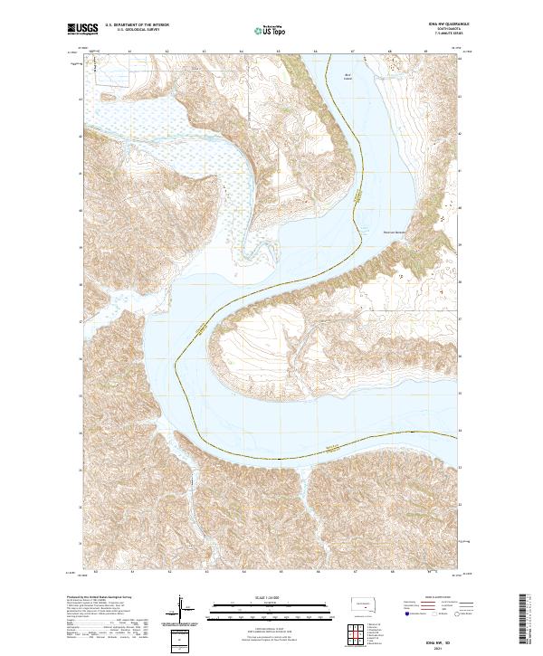
2021 Map of Iona NW
USGS Topo · Published 2021About this map
Lake Francis Case dominates the eastern half of this landscape, tracing the county line between Lyman and Brule counties. The confluence of the White River and the reservoir creates a complex network of wetlands and shifting shorelines, including the broad alluvial plains of Peterson Bottoms and the isolated Bird Island. The terrain is defined by dramatic drainage patterns where Bull Cr, Waterhole Cr, and Nicholas Cr carve deep draws into the Missouri River breaks. The modern infrastructure of 252nd St and Canyon Rd provides limited access to these riverine lowlands, illustrating the persistent isolation of the South Dakota prairie where the river system continues to dictate the local geography.
Find a feature on this map
17 named features on this map. Tap any name to fly to it.
Don’t see what you’re looking for? This feature index may not catch every label — zoom into the map to look around manually.
Map Details
Editions of this 2021 Iona NW Map
This is the sole edition of this map. No revisions or reprints were ever made.
Other maps of this area

1935 · Chamberlain
USGS Topo · 1:62,500

1939 · Chamberlain
USGS Topo · 1:62,500

1940 · Iona
USGS Topo · 1:62,500

1944 · Iona
USGS Topo · 1:62,500

1952 · Reliance SE
USGS Topo · 1:24,000

1952 · Hamill NE
USGS Topo · 1:24,000

1952 · Oacoma
USGS Topo · 1:24,000

1952 · Iona NW
USGS Topo · 1:24,000

1955 · Mitchell
USGS Topo · 1:250,000

1959 · Mitchell
USGS Topo · 1:250,000