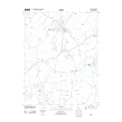
2012 Map of Ione
USGS Topo · Published 2012About this map
Ione Valley serves as the geographic heart of this Amador County region, where the city of Ione is established at the confluence of Mule Cr and Sutter Cr. The landscape is a mosaic of agricultural and industrial history, evidenced by the presence of Greenstone Winery and Jackson Valley Vineyard alongside specialized settlements like Firebrick. Genealogists will find the Catholic Cem and Ione Protestant-Community Cem near the town center particularly significant for tracing local family histories. To the south, the terrain transitions into the Jackson Valley, punctuated by landmarks such as Buena Vista Peaks and the expansive Camanche Reservoir. Small aviation hubs like Camanche Skypark and Howard Airport illustrate the modern accessibility of these rural valleys, while the Ione Canal highlights the area's long-standing water management needs.
Find a feature on this map
78 named features on this map. Tap any name to fly to it.
Don’t see what you’re looking for? This feature index may not catch every label — zoom into the map to look around manually.
Map Details
Editions of this 2012 Ione Map
This is the sole edition of this map. No revisions or reprints were ever made.
Other maps of this area

1889 · Jackson
USGS Topo · 1:125,000

1892 · Jackson
USGS Topo · 1:125,000

1894 · Lodi
USGS Topo · 1:125,000

1897 · Jackson
USGS Topo · 1:125,000

1902 · Jackson
USGS Topo · 1:125,000

1909 · Carbondale
USGS Topo · 1:31,680

1909 · Goose Creek
USGS Topo · 1:31,680

1909 · Clements
USGS Topo · 1:31,680
1939 · Bellota
USGS Topo · 1:62,500

1941 · Sutter Creek
USGS Topo · 1:62,500